Navionics Web API
Add Navionics charts to your website! Navionics Web API v2 is out!Features
Boating Map
The Web API allows visitors to your website to see your content while they pan and zoom to view Navionics charts. This includes SonarCharts™ HD bathymetry, which can be toggled off and on for quick comparison with traditional nautical charts. Integration with third party maps such as Bing (Google and Leaflet with limited features), enables you to add points or draw lines and polygons for a richer experience.
Friendly
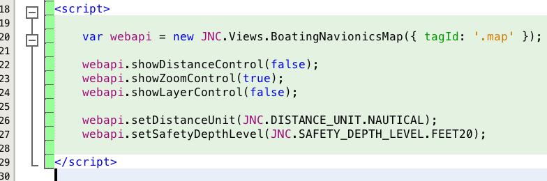
Navionics Web API is implemented in object oriented API that aims to provide more readable code. There are many examples of JS libraries that use some variant of this approach: jQuery probably being the most well-known.
Extensible

Navionics Web API is based on OpenLayers 3.0.0, an open source (provided under the 2-clause BSD License) JavaScript library for displaying map data in web browsers. OpenLayers provides an API for building rich web-based geographic applications and you can use it to extend the Navionics Web API.